

Location... Location... Location
Musings: We often hear realtors using the phrase "location, location, location." What about Alaska made it a desirable location for countries around the world during World War II?
* * * * *
Essential: Explain how Alaska's location was considered 'strategic' during World War II. What were the war activities/events that supported the perspective of 'strategic' Alaska?
History:
1935 - Brigadier General William Mitchell urged Congress to adopt a strong northern air defense stating "he who holds Alaska will hold the world."
December 1941 - Japan's attack on Pearl Harbor
June 1942 - Japan's bombing of Dutch Harbor on Unalaska Island
1942 - Japan's invasion of Attu and Kiska Islands
May 1943 - U.S. forces landed on Attu to retake island
August 1943 - U.S. foces retake Kiska island
Strategic Focus:
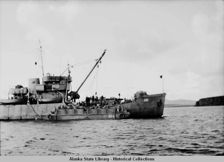
Airplanes departing from Kodiak and Dutch Harbor did not have the range to engage the Japanese at Attu and Kiska. In order for the US to be strategic in the war efforts, US forces built Alaska military bases. The bases contructed on other Aleutian islands, allowed the pilots to engage in air strikes further and further west into Japanese territories.
 |
| Major Military Locations in AK (Google Im) |
When the Japanese attacked Attu and Kiska in 1942, this was the first time since the war of 1812 when invading military had occupied American soil (www.alaskahistoricalsociety.org). This presented itself as a vulnerable threat U.S. territories. The island of Attu is only 750 miles from the northernmost of the Japanese islands (www.alaskool.org/projects). The U.S. Government once again accelereated its efforts to establish military support in Alaska.
The terrain and climate of Alaska were both difficult for "outsiders" from the lower-48. Alaskan Natives joined military units, including Army and Territorial Guard to help patrol the coastlines and lead reconnaissance missions in unknown fighting areas.
 |
| Alaska Territorial Guard Poster (Google Images) |
 |
| Territorial Guard in Sitka, 1944 (Google Images) |
 |
| US Coastguard Clover in Pribiloffs, 1943 (Google Images) |
 |
| Unalakleet Family, 1945 (Google Images) |
The U.S. Government and Military maximized on "the fear of repeated attacks" by Japanese to engage the U.S. citizens with the military efforts. The Aleutian Campaign was a strategic military objective as well as a psychological objective. Americans generally felt VULNERABLE with the knowledge of American soil occupied by an enemy. U.S. military capitalized on this point to build additional military presence in remote locations throughout Alaska. (http://explorealaskablog.blogspot.com)
 |
| Land-Lease Propaganda, 1943 (Google Im) |
 |
| Pacific Rim Perspective (Google Images) |
Those of us that lived in the lower-48 have a different perspective of the location of Alaska in reference to Eastern Europe/Asia. We see it far north of main transportation lines. However, from the northern perspective of Alaska, we live in transportation "hub."
Transportation/communication inter-connectedness during WWII:
[1] The Aleutian chain consists of approximately 120 islands stretching over a 1,000 mile distance. Dutch Harbor on the island of Unalaska provided a relatively good anchorage for the Navy. This naval base is approximately 2,000 miles from both Honolulu and San Francisco.
[2]wartime construction increased with revenues from Russia, Alaska and the lower-48. From 1939 to September 1941, there was increase of military personnel from 1,000 to nearly 35,000. Alaskan infrastructure was necessary to support the increase of the military personnel and their personal and military needs.
[3] planes routed through Alaska serving military and commercial needs in Russia and Germany. These planes "leapfrogged" from contiguous U.S. soil through the Canadian and Alaskan wilderness to military installations in Alaska and onward to Siberia.
[4] In 1942, additional strategic plans began with the construction of the Alaska Highway.
(www.alaskahistoricalsociety.org)
(World War II in Alaska: A Resource Guide for Teachers and Students)
 |
| Alaska Highway Route Map (Google Images) |
The Alaska Highway -- why expend the funds?
The idea of a highway connecting the "lower 48" to Alaska had been in discussion and planning stages since the 1920s. However, no actual construction began until 1942. President Franklin D Roosevelt obtained approval from the U.S. Congress to begin construction on February 6, 1942. Construction actually began March 8, 1942. Canada allowed the United States to cross Canadian territory and build the highway as long as the U.S. covered the total cost. Canada also negotiated to have the highway deeded back to their country after World War II. The road was originally built by the U.S. Army as a supply route from the lower 48 to Alaska, extending from Dawson Creek to Delta Junction. The highway was completed in September 1942 and opened to the public in 1948. Today, the Alaska Highway, also called the ALCAN Highway is approximately 1400 miles long. The change in length was due to re-routing and reconstructions of numerous sections.
What kicked the construction into "high-gear?"
* Attack on Pearl Harbor and the threat to the U.S. Territories (Dec 7, 1941)
* Japanese invasion of Kiska Island and Attu Island (June 6 & 7, 1942)
* Linking airfields between the 'Northwest Staging Route' sending assistance to Russia through northwest Canada (from Montana to Fairbanks) (www.alaskahistoricalsociety.org)
* Connecting contiguous U.S. to Alaska through Canadian territory
The cost of constructing the Alaska Highway was $138 million (historynet.com).
Extend:
 |
| Anti-Aircraft Observation, St Paul, AK (Google Images) |
The only military installation in Juneau is the Coast Guard Facility. This facility was originally opened in Auke Bay in the mid-1950s and stayed there until the current facility, just northwest of downtown Juneau opened in 1978.
 |
| Makhnati Island Near Sitka (Google Images) |
Locations of Gun Batteries:
Shoals Point
Makhnati Island
Biorka Island
Watson Point
Whale Island
Lava Point
Clam Island
Kayak Island
Lisianski Peninsula
Little Biorka Island
Ataku Island
Radar Positions: Searchlight Positions:
Abalone Island Shoals Point
St. Lazaria Island Sound Island
Biorka Island Lisianski Peninsula
Makhnati Island Kayak Island
Harbor Mountain Little Biorka Island
Ataku Island
Evaluation:
I had been in the dark about the strategic location of Alaska during WW II. There has been much publicity about Pearl Harbor and movies that captured the Japanese war acts against the U.S. in this state. There is very little published or retold about the attacks at Attu and Kiska. I am thankful that I have learned more about U.S. history from this Alaska perspective.
Final Thought:
A soldier stood at the Pearly Gates;
His face was warn and old.
He gently asked the man of fate
Admission to the fold.
"What have you done," Saint Peter asked,
"To gain admission here?"
"I've been in the Aleutians
For nigh unto a year."
Then the gates swung open sharply
As Saiint Peter tolled the bell.
"Come in," said he, "and take a harp.
You've had your share of hell."
(Warrant Officer Boswell Boomhower)
Wonderful illustrations. Your links were really easy to use. I hadn’t thought of incorporating additional media like Utube. Brad you did a really nice job on your blog, very descriptive.
ReplyDelete